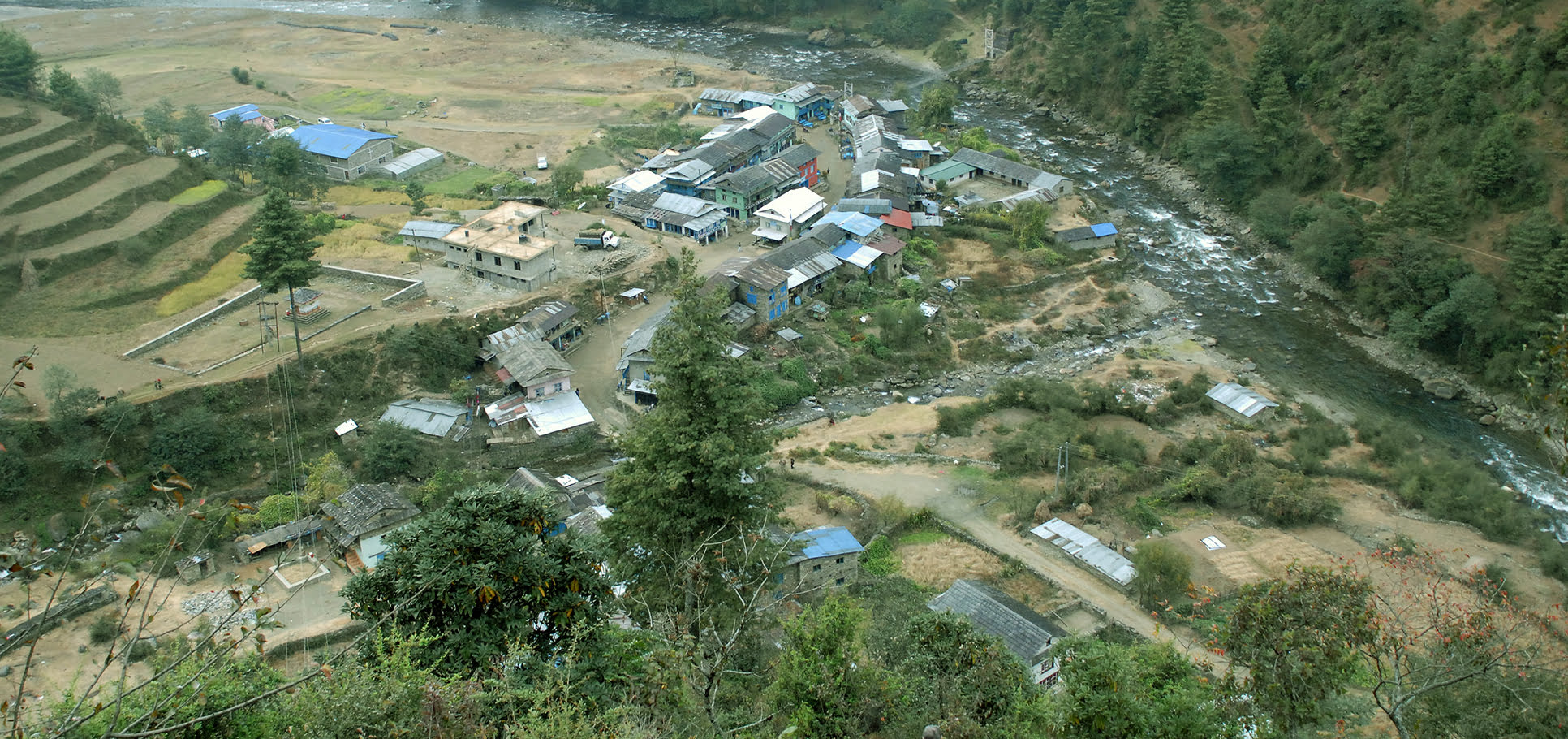
Shivalaya is a magnificent place located at Gokulganga Rural Municipality in Ramechhap district of Nepal. It is situated at an altitude of 1800m above sea level. It is a small lovely village lying on the bank of the Gokulganga River. It is 17.6 Km far from Jiri which takes around 1 hours by bus. It is located in between the border of Ramechhap and Dolakha district of Nepal.
Shivalaya is considered as a transit point for the visitor who wants to visit Gaurishankar Conservation area. Total area of Gaurishankar Conservation area is 2179 square kilometers which covers the area of Sindhupalchok, Ramechhap and Dolakha district of Nepal. This conservation area consists of 16 vegetation, 34 species of mammalia, 235 species of bird, 14 species of snake, 16 species of fish, 10 types of amphibian, and 8 species of lizard.
The Hindu religious Temple Ghusmeshwor Shiva Mandir is also located at Shivalaya, Ramechhap. During festivals like teej(greatest festival of hindu women), Shivaratri, Balachatudashi grand fair is organized in this temple.
Trekking that can be started from Shivalaya
Shivalaya is considered as a gateway for lots of famous trekking routes in Nepal including Shivalaya to Chola Pass, Shivalaya to Namche Bazaar, Shivalaya to Lukla Pass, Shivalaya to PanchPokhari, Shivalaya to Everest Base Camp, and so on. Among all the trails, the most famous trekking route is Shivalaya to Everest Base Camp.
Shivalaya to Everest Base Camp Trek
Shivalaya is the entrance gate to Everest Base Camp. It is a 19 days trek which costs around US$1700. It is one of the exciting treks where we can experience the feeling of crossing the suspension bridge above a fast flowing river. People following Hindu, Buddhist and Kirant religious people living in harmony is the best thing we can see during trek to Everest Base Camp. The scenic hills and mountains throughout the journey adds extra beauty to the trek. Majestic view of Gaurisankar Range, LangtangHimal, Mt. Everest etc. makes the journey more amusing.
Short Itinerary
| Day 1 | 9-10 hours’ drive from Kathmandu(1300m) to Shivalaya(1800m) |
| Day 2 | Trek to Bhandar(2200m) from Shivalaya(1800m) |
| Day 3 | Trek from Bhandara(2200m) to Sete(2645m) |
| Day 4 | Trek from Sete(2645m) to Jumbesi(2700m) |
| Day 5 | Trek from Jumbesi(2700m) to Nunthala(2000m) |
| Day 6 | Trek from Nunthala(200m) to Kharihola(1985m) |
| Day 7 | Trek from Kharikhola(1985m) to Surkhe(2290m) |
| Day 8 | Trek from Surkhe(2290m) to Phakding(2610m) |
| Day 9 | Trek from Phakding(2610m0 to Namche(3440m) |
| Day 10 | Stay at Namche Bazaar for acclimatization |
| Day 11 | Trek from Namche Bazaar(3440m) to Tengboche(3790m) |
| Day 12 | Trek from Tengboche(3790m) to Dingboche(4410m) |
| Day 13 | Trek from Dingboche(4410m) to Chukung valley(4760m) |
| Day 14 | Trek from Chukung valley to Lobuche (4910m) |
| Day 15 | Trek to Gorakshep(5550m), to Everest Base Camp(5545m), and back to Gorakshep |
| Day 16 | Trek back to Pheriche(4240m) |
| Day 17 | Trek back to Namche Bazaar |
| Day 18 | Trek from Namche Bazaar to Lukla |
| Day 19 | Take flight from Lukla to came back to Kathmandu |
-Article Written By: Anita Khatri for Land Nepal


